1. Toba Caldera, Indonesia
The Toba Caldera, nestled in the heart of Sumatra, Indonesia, stands as a testament to the Earth’s capacity for cataclysmic events. Approximately 74,000 years ago, this super volcano unleashed one of the most devastating eruptions in our planet’s history, an event that would leave an indelible mark on both the landscape and the course of human evolution. The eruption, registering a staggering 8 on the Volcanic Explosivity Index (VEI), ejected an estimated 2,800 cubic kilometers of volcanic material into the atmosphere – a volume that dwarfs any volcanic event in recorded history.
The aftermath of the Toba eruption was nothing short of apocalyptic. A thick blanket of ash and aerosols enveloped the Earth, plunging the planet into a volcanic winter that may have lasted for years. This dramatic cooling period is believed to have had far-reaching consequences on global climate patterns, potentially triggering a bottleneck in human population. Some researchers suggest that the human population may have been reduced to as few as 3,000-10,000 individuals, although this theory remains a subject of ongoing debate among scientists.
The Toba event’s impact on early human populations continues to fascinate anthropologists and geneticists. The eruption coincided with a critical period in human evolution, potentially influencing migration patterns and accelerating genetic differentiation among isolated groups. The harsh environmental conditions following the eruption may have acted as a powerful selective force, favoring adaptable individuals and potentially shaping the genetic makeup of modern humans.
Today, the Toba Caldera exists as a serene lake, belying its turbulent past. Lake Toba, spanning an area of 1,145 square kilometers, stands as the largest volcanic lake in the world. Its placid waters and surrounding lush landscapes offer little hint of the immense forces that shaped this region millennia ago. However, for scientists, the Toba Caldera remains an invaluable site for studying the long-term effects of super volcanic eruptions on climate, ecosystems, and human evolution. Ongoing research at Toba continues to yield insights into the Earth’s geological processes and the intricate interplay between volcanic activity and global climate systems, underscoring the importance of understanding these massive geological events in the context of our planet’s past and potential future.
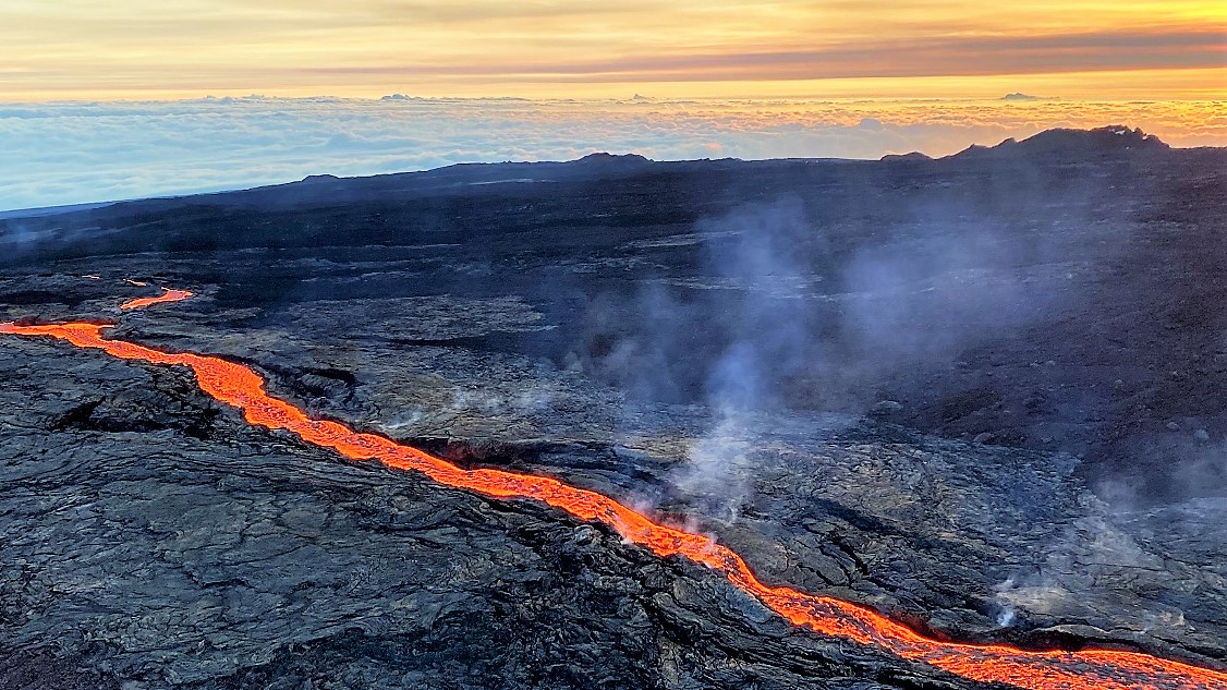
2. Yellowstone Caldera, USA
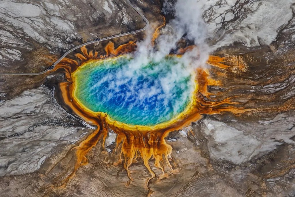
The Yellowstone Caldera, often referred to as the Yellowstone Supervolcano, is a geological marvel that lies at the heart of Yellowstone National Park in the western United States. Spanning an area of approximately 3,472 square kilometers, this massive caldera is the product of three cataclysmic eruptions that occurred over the past 2.1 million years. The most recent of these eruptions, which took place about 631,000 years ago, ejected more than 1,000 cubic kilometers of rock and ash into the atmosphere, dramatically altering the surrounding landscape and potentially influencing global climate patterns.
What makes Yellowstone particularly fascinating is its status as an active geological hotspot. Beneath the park’s iconic features – its geysers, hot springs, and fumaroles – lies an enormous magma chamber that continues to fuel the region’s geothermal activity. This vast reservoir of molten rock, estimated to be about 60 kilometers long and 30 kilometers wide, is a constant reminder of the immense power that lies dormant beneath the Earth’s surface.
The Yellowstone Caldera’s potential for future eruptions has captured the imagination of both scientists and the public. While the probability of another supereruption occurring in the near future is extremely low, the consequences of such an event would be profound. A VEI 8 eruption at Yellowstone could potentially cover much of North America in ash, disrupt global weather patterns, and have far-reaching effects on agriculture and infrastructure worldwide.
However, it’s crucial to note that Yellowstone’s activity is not limited to catastrophic eruptions. The park experiences frequent earthquakes, most of which are too small to be felt by humans, and periodic ground deformation as magma and hydrothermal fluids move beneath the surface. These ongoing processes provide scientists with valuable data about the caldera’s behavior and potential future activity.
Yellowstone’s unique geological features have made it a natural laboratory for studying volcanic systems and their impacts on surrounding ecosystems. The park’s diverse array of thermal features, including the famous Old Faithful geyser, are home to extremophile organisms that thrive in harsh conditions. These organisms have become the subject of extensive research, offering insights into the limits of life on Earth and potentially on other planets.
The Yellowstone Caldera serves as a stark reminder of the dynamic nature of our planet and the powerful forces that shape it. As research continues, scientists hope to gain a deeper understanding of this geological wonder, improving our ability to predict and prepare for potential volcanic activity not just at Yellowstone, but at similar systems around the world.
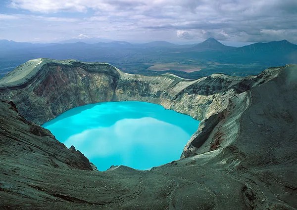
3. Lake Taupo, New Zealand
Lake Taupo, nestled in the heart of New Zealand’s North Island, is a picturesque body of water that conceals a tumultuous geological past. This serene lake is, in fact, the caldera of one of the world’s most formidable supervolcanoes, formed by a series of massive eruptions over the past 300,000 years. The most recent and arguably most significant of these eruptions occurred approximately 26,500 years ago, an event known as the Oruanui eruption.
The Oruanui eruption was a cataclysmic event that reshaped the landscape of the North Island. Registering as an 8 on the Volcanic Explosivity Index (VEI), it ejected an estimated 1,170 cubic kilometers of material, making it one of the largest known eruptions in the last 70,000 years. This eruption not only created the modern outline of Lake Taupo but also blanketed much of New Zealand’s North Island in thick layers of ash and pumice. The far-reaching effects of this eruption are evidenced by the discovery of Oruanui ash in deep-sea cores as far away as the Chatham Rise, over 1,000 kilometers to the southeast.
The Taupo Volcanic Zone, of which Lake Taupo is a part, is one of the most active volcanic areas in the world. This region is characterized by its high heat flow, frequent earthquakes, and numerous geothermal features. The volcanic activity in this area is driven by the subduction of the Pacific Plate beneath the Australian Plate, creating a complex geological environment that continues to shape the landscape of New Zealand.
While the Oruanui eruption was the largest in Taupo’s recent geological history, it was not the last. Approximately 1,800 years ago, the Taupo eruption occurred, marking the most recent major event in the volcano’s history. Although smaller than the Oruanui eruption, this event still had significant impacts, producing pyroclastic flows that traveled over 80 kilometers from the vent and creating a towering eruption column that may have reached heights of 50 kilometers or more.
Today, Lake Taupo appears peaceful, its clear waters a popular destination for tourists and outdoor enthusiasts. However, beneath this tranquil surface, the volcano remains active. Ongoing monitoring by New Zealand’s GeoNet project has detected periodic swarms of earthquakes and ground deformation, indicators of the dynamic processes continuing beneath the lake. These observations serve as a reminder of the potential for future volcanic activity in the region.
The geological history of Lake Taupo provides valuable insights into the behavior of large caldera-forming volcanoes and their potential impacts on climate and ecosystems. Ongoing research at Taupo aims to better understand the processes that lead to such massive eruptions and to improve our ability to predict and prepare for future volcanic events. As one of the world’s most powerful supervolcanoes, Lake Taupo remains a critical site for volcanological research and a stark reminder of the Earth’s capacity for dramatic geological change.
4. Valles Caldera, USA
The Valles Caldera, located in the Jemez Mountains of northern New Mexico, USA, stands as a testament to the Earth’s capacity for cataclysmic geological events. This expansive depression, spanning approximately 22 kilometers in diameter, is the result of a massive volcanic eruption that occurred approximately 1.25 million years ago. This eruption, known as the Valles event, was one of the largest in North America’s geological history, ejecting more than 300 cubic kilometers of material and registering as a VEI 8 on the Volcanic Explosivity Index.
The formation of the Valles Caldera was a complex process that unfolded over millions of years. The Jemez volcanic field, of which the caldera is a part, began its activity around 14 million years ago. However, it was the Valles event that truly shaped the landscape we see today. As magma was expelled from the underground chamber during the eruption, the overlying rock collapsed, creating the vast circular depression that characterizes the caldera. The eruption produced extensive ash falls and pyroclastic flows, leaving deposits that can be found across much of the southwestern United States.
In the aftermath of this cataclysmic event, the Valles Caldera entered a period of resurgent doming and smaller eruptions. This activity continued for hundreds of thousands of years, creating a complex landscape of smaller volcanic domes, hot springs, and fumaroles within the main caldera. The most recent volcanic activity in the area occurred approximately 40,000 years ago, suggesting that while the system has been quiet in recent geological time, it is not extinct.
Today, the Valles Caldera presents a diverse and ecologically rich environment. The collapse and subsequent filling of the caldera created a unique topography that includes expansive grasslands, forested mountains, and numerous streams and wetlands. This varied landscape supports a wide array of plant and animal species, making the area a haven for biodiversity. The caldera’s geological features, including its hot springs and gas vents, also provide habitats for specialized microbial communities, offering scientists valuable opportunities to study life in extreme environments.
The Valles Caldera is not just a site of geological and ecological importance; it also holds significant cultural value. For thousands of years, various Native American peoples have lived in and around the caldera, considering it a sacred place. The area has been used for hunting, gathering, and spiritual practices, leaving behind a rich archaeological record that provides insights into human adaptation to this unique environment over millennia.
In recent years, the Valles Caldera has become an important site for scientific research across multiple disciplines. Geologists study its formation and evolution to better understand the processes behind large caldera-forming eruptions. Ecologists examine its diverse ecosystems and how they have been shaped by the area’s volcanic history. Climate scientists analyze sediment cores from the caldera’s wetlands, using them as archives of past climate change in the region.
While the Valles Caldera is currently in a dormant state, it remains an active volcanic system. Ongoing monitoring by the United States Geological Survey includes regular measurements of seismic activity, ground deformation, and changes in gas emissions. These efforts aim to detect any signs of renewed activity that could potentially lead to future eruptions. Although the likelihood of another VEI 8 eruption in the near future is extremely low, understanding the caldera’s behavior is crucial for assessing potential volcanic hazards in the region.
The Valles Caldera serves as a vivid reminder of the powerful geological forces that have shaped our planet. Its study continues to yield valuable insights into volcanic processes, ecosystem dynamics, and human interactions with volcanic landscapes, underscoring the importance of preserving and studying these unique geological features.
5. Long Valley Caldera, USA
The Long Valley Caldera, situated in eastern California along the Sierra Nevada mountain range, is a remarkable testament to the Earth’s volcanic power. This vast depression, spanning approximately 32 kilometers in length and 18 kilometers in width, was formed by a catastrophic eruption that occurred about 760,000 years ago. This event, known as the Bishop Tuff eruption, was one of the largest volcanic eruptions in North America’s recent geological history, ejecting an estimated 600 cubic kilometers of material and registering as a VEI 8 on the Volcanic Explosivity Index.
The formation of the Long Valley Caldera was a dramatic event that reshaped the surrounding landscape. As magma was explosively ejected from the underground chamber, the overlying crust collapsed, creating the enormous caldera we see today. The eruption produced vast pyroclastic flows that traveled for tens of kilometers, depositing thick layers of ash and pumice. These deposits, known as the Bishop Tuff, can be found across much of the western United States, serving as a key stratigraphic marker for geologists studying the region’s geological history.
In the aftermath of the caldera-forming eruption, the Long Valley area entered a period of continued volcanic activity. This included the formation of numerous smaller volcanic domes and cones within and around the caldera, as well as the development of extensive hydrothermal systems. The most recent eruptions in the area occurred approximately 16,000-17,000 years ago, producing the Mono-Inyo Craters chain along the caldera’s western rim. This relatively recent activity serves as a reminder that the Long Valley Caldera, while currently quiet, is not an extinct volcanic system.
The Long Valley Caldera is notable not just for its past eruptions, but also for its ongoing geothermal activity. The area is home to numerous hot springs, fumaroles, and gas vents, all testaments to the heat still present beneath the surface. These geothermal features have attracted human interest for centuries, from indigenous peoples who utilized the hot springs for their therapeutic properties to modern geothermal energy projects that harness the Earth’s heat for electricity production.
In the 1980s, the Long Valley Caldera became the focus of intense scientific scrutiny due to a period of increased geological unrest. This activity included earthquake swarms, ground deformation, and changes in gas emissions, raising concerns about the potential for renewed volcanic activity. While this unrest has since subsided, it prompted the establishment of comprehensive monitoring systems by the United States Geological Survey. These systems continue to provide valuable data on the caldera’s behavior, helping scientists better understand the processes occurring beneath the surface.
The Long Valley Caldera and its surrounding area present a unique ecological environment. The caldera floor, once a vast lake in the millennia following the Bishop Tuff eruption, is now home to expansive meadows and forests. The region’s varied topography and numerous thermal features create diverse habitats that support a wide range of plant and animal species. This biodiversity, coupled with the area’s stunning scenery, has made the Long Valley region a popular destination for outdoor enthusiasts and nature lovers.
From a scientific perspective, the Long Valley Caldera continues to be an invaluable natural laboratory. Geologists study its formation and evolution to gain insights into the processes behind large caldera-forming eruptions. The area’s hydrothermal systems provide opportunities to study extremophile organisms, offering potential clues about the limits of life on Earth and possibly other planets. Additionally, climate scientists analyze sediment cores from the caldera’s ancient lake beds, using them as archives of past climate change in the western United States.
As research continues, the Long Valley Caldera serves as a stark reminder of the dynamic nature of our planet. Its study not only enhances our understanding of volcanic processes but also contributes to our ability to assess and mitigate volcanic hazards in similar systems worldwide. The Long Valley Caldera stands as a testament to the Earth’s capacity for dramatic change and the ongoing influence of geological processes on our landscapes and ecosystems.
6. Campi Flegrei, Italy
The volcanic activity at Campi Flegrei is characterized by a phenomenon known as bradyseism – the gradual uplift or descent of the Earth’s surface. This process has dramatically affected the local landscape over centuries. The ancient Roman market town of Pozzuoli, located within the caldera, has experienced significant vertical displacement due to bradyseism. The most famous example of this is the Macellum of Pozzuoli, an ancient Roman marketplace whose marble columns bear marks of marine mollusks several meters above the current sea level, providing clear evidence of the ground’s movement over time.
In recent decades, Campi Flegrei has shown signs of unrest that have caught the attention of volcanologists worldwide. Two significant episodes of ground uplift occurred in 1969-1972 and 1982-1984, raising the ground in Pozzuoli by 1.7 meters and 1.8 meters respectively. These events were accompanied by intense seismic activity and changes in the geochemistry of fumaroles, leading to the temporary evacuation of thousands of residents from the area.
Since 2005, Campi Flegrei has entered a new phase of uplift, albeit at a slower rate than the previous crises. This ongoing unrest has prompted intensified monitoring efforts and debates among scientists about the potential for future eruptive activity. The complex interplay between magmatic and hydrothermal processes beneath Campi Flegrei makes it challenging to predict its behavior accurately.
Despite its potential dangers, Campi Flegrei is also a region of immense natural beauty and historical significance. The area is dotted with crater lakes, thermal springs, and fumaroles, creating a unique landscape that has attracted visitors for centuries. The volcanic soil has made the region exceptionally fertile, supporting a rich tradition of agriculture and viticulture.
From a scientific perspective, Campi Flegrei offers invaluable opportunities for studying the behavior of large caldera systems and their impact on densely populated areas. Ongoing research focuses on improving eruption forecasting methods, understanding the mechanisms driving bradyseism, and developing more effective strategies for volcanic risk management in urban areas.
As one of the world’s most dangerous volcanoes, Campi Flegrei serves as a stark reminder of the delicate balance between human civilization and the powerful geological forces that shape our planet. The continued study and monitoring of this volcanic system are crucial not only for the safety of the millions living in its vicinity but also for advancing our understanding of volcanic processes and improving our ability to mitigate volcanic risks worldwide.
7. Aira Caldera, Japan
The Aira Caldera, located in Kagoshima Prefecture on the island of Kyushu, Japan, is a geological marvel that exemplifies the dynamic and often tumultuous relationship between human civilization and volcanic activity. This massive caldera, measuring approximately 17 kilometers in diameter, was formed by a catastrophic eruption about 22,000 years ago. This eruption, known as the Aira-Tanzawa event, ejected an estimated 400 cubic kilometers of material, drastically altering the landscape of southern Kyushu and potentially impacting global climate patterns.
At the heart of the Aira Caldera lies Sakurajima, one of Japan’s most active volcanoes and a constant reminder of the region’s volatile geology. Sakurajima, once an island in Kagoshima Bay, became connected to the mainland during a major eruption in 1914. This eruption, the largest in Japan during the 20th century, lasted for months and produced massive lava flows that bridged the gap between the volcano and the Osumi Peninsula.
Sakurajima’s frequent eruptions, characterized by ash plumes and occasional pyroclastic flows, have made it a subject of intense scientific study and a central focus of Japan’s volcanic monitoring efforts. The volcano’s proximity to Kagoshima City, with a population of over 600,000 people, presents significant challenges for volcanic hazard management and has necessitated the development of sophisticated early warning systems and evacuation procedures.
The geological setting of the Aira Caldera is complex, influenced by the subduction of the Philippine Sea Plate beneath the Eurasian Plate. This tectonic activity has created a series of volcanic centers along the Kagoshima Graben, a rift valley that includes the Aira Caldera and extends southward to the Kikai Caldera. This geological context contributes to the region’s high level of volcanic and seismic activity.
Despite the inherent risks, the area around the Aira Caldera has been continuously inhabited for thousands of years. The fertile volcanic soils have supported agriculture, while the dramatic landscapes and numerous hot springs have made the region a popular tourist destination. This long history of human habitation in close proximity to active volcanism provides valuable insights into the coexistence of human societies with dynamic geological environments.
From a scientific perspective, the Aira Caldera and Sakurajima offer unparalleled opportunities for studying various aspects of volcanism. Researchers investigate topics ranging from magma chamber dynamics and eruption mechanisms to the environmental and health impacts of prolonged ash fall. The frequent activity of Sakurajima also allows for the testing and refinement of volcanic monitoring techniques and eruption prediction models.
The management of volcanic risks in the Aira Caldera region exemplifies the challenges faced by many volcanic areas worldwide. It involves a delicate balance between economic development, public safety, and scientific research. The experiences and strategies developed here have implications for volcanic risk management globally, especially in other densely populated volcanic regions.
As we continue to study and monitor the Aira Caldera and Sakurajima, we gain not only a deeper understanding of Earth’s geological processes but also valuable lessons in resilience and adaptation. The ongoing story of this remarkable volcanic system serves as a powerful reminder of the need for continued vigilance, research, and international cooperation in the face of natural hazards.
8. Ischia, Italy
Ischia, a picturesque island located in the Tyrrhenian Sea about 30 kilometers southwest of Naples, Italy, is a volcanic complex with a rich geological history that spans over 150,000 years. Often overshadowed by its more famous neighbor, Mount Vesuvius, Ischia nonetheless represents a significant volcanic system with its own unique characteristics and potential hazards.
The island of Ischia is essentially the exposed summit of a large volcanic structure that rises nearly 1,000 meters from the sea floor. Its geological evolution has been marked by numerous eruptions, caldera collapses, and resurgent episodes. The most prominent feature of Ischia’s volcanism is Mount Epomeo, a volcanic horst that dominates the island’s landscape, rising to an elevation of 789 meters above sea level.
Ischia’s volcanic history is complex and diverse. The island has experienced a wide range of eruptive styles, from effusive lava flows to explosive eruptions that produced pyroclastic deposits. The last recorded eruption on Ischia occurred in 1302 AD, producing the Arso lava flow on the island’s eastern flank. However, the absence of recent eruptions does not indicate that the volcanic system is extinct. Ongoing seismic activity, ground deformation, and the presence of numerous fumaroles and hot springs attest to the continued activity of the magmatic system beneath the island.
One of the most intriguing aspects of Ischia’s geology is the phenomenon of volcanic resurgence. Following a caldera-forming eruption approximately 55,000 years ago, the central part of the island has been gradually uplifted, forming Mount Epomeo. This resurgent doming has raised marine deposits to elevations of over 700 meters above sea level, providing clear evidence of the dramatic vertical movements that have shaped the island over time.
The volcanic nature of Ischia has significantly influenced its human history and current socio-economic conditions. The island’s fertile volcanic soils, coupled with its mild Mediterranean climate, have supported agriculture for millennia. The numerous thermal springs, fueled by the residual heat of the magmatic system, have made Ischia a popular health and wellness destination since ancient Roman times.
However, the volcanic and seismic hazards associated with Ischia pose significant challenges for the island’s large permanent population and millions of annual visitors. The potential for future eruptions, coupled with the risk of earthquakes and landslides, necessitates careful monitoring and robust emergency planning. The 2017 earthquake, which caused significant damage and casualties, served as a stark reminder of the island’s geological instability.
From a scientific perspective, Ischia provides valuable opportunities for studying various aspects of volcanism and related phenomena. Researchers investigate topics such as the mechanisms of caldera resurgence, the evolution of magmatic systems over long time scales, and the interactions between volcanic processes and groundwater systems. The island also serves as an important case study for volcanic risk assessment and management in tourist-heavy, economically vital areas.
The story of Ischia is one of both natural beauty and potential peril, a microcosm of the complex relationships between volcanic landscapes and human societies. As research continues, our understanding of Ischia’s geological past and potential future scenarios deepens, contributing to better hazard assessments and mitigation strategies not only for this island but for similar volcanic systems worldwide.
Ischia stands as a testament to the dynamic nature of our planet, showcasing the ongoing interplay between geological forces and human civilization. Its study continues to yield valuable insights into volcanic processes, the long-term evolution of magmatic systems, and the challenges of living in volcanically active regions.
9. La Garita Caldera, USA
La Garita Caldera, nestled in the heart of southern Colorado’s San Juan Mountains, stands as a testament to one of the most cataclysmic volcanic events in Earth’s recent geological history. This ancient supervolcano, now a serene landscape of rolling hills and deep valleys, was the site of an eruption so massive that it defies easy comprehension, even by geological standards.
Approximately 27.8 million years ago, during the late Oligocene epoch, La Garita Caldera experienced a truly colossal eruption. This event, registering a staggering 8 on the Volcanic Explosivity Index (VEI), ejected an estimated 5,000 cubic kilometers of material – a volume that dwarfs any volcanic eruption in human history. To put this in perspective, it was about 5,000 times larger than the 1980 eruption of Mount St. Helens.
The product of this enormous eruption was the Fish Canyon Tuff, an immense deposit of volcanic ash and rock that covered an area of over 11,000 square kilometers. At its thickest points, this tuff layer reached depths of up to 2 kilometers. The sheer scale of the Fish Canyon Tuff makes it one of the largest known single volcanic deposits on Earth, and its study has provided invaluable insights into the mechanics of super-eruptions.
The eruption that formed La Garita Caldera was so powerful that it likely had significant impacts on global climate and ecosystems. The vast quantities of ash and gases released into the atmosphere would have led to a period of global cooling, potentially altering weather patterns and affecting plant and animal life across wide regions.
Today, the La Garita Caldera spans an area of approximately 35 by 75 kilometers, making it one of the largest known calderas on Earth. However, due to millions of years of erosion and subsequent geological activity, the caldera’s original boundaries are not always easily discernible to the untrained eye. The landscape has been reshaped by time, with parts of the caldera rim now forming scenic mountain peaks and ridges in the San Juan Mountains.
The geology of La Garita Caldera is complex and multi-layered. The Fish Canyon Tuff, despite its enormous volume, represents just one of several major eruptions in the area over millions of years. The San Juan volcanic field, of which La Garita is a part, has a long history of volcanic activity that has profoundly shaped the region’s topography.
For geologists, La Garita Caldera and the Fish Canyon Tuff provide a unique natural laboratory for studying super-eruptions and their long-term effects. Research at the site has yielded important insights into magma chamber dynamics, eruption mechanisms, and the processes that lead to such enormous accumulations of eruptible magma. The study of minerals within the tuff has also provided valuable data on the pre-eruption conditions deep within the Earth’s crust.
While La Garita Caldera is now extinct and poses no volcanic threat, its study remains crucial for understanding the potential impacts of future super-eruptions elsewhere on Earth. The lessons learned from La Garita inform models and predictions about other active supervolcanoes, such as Yellowstone.
The area around La Garita Caldera, with its dramatic landscapes carved by volcanic activity and subsequent erosion, is now a haven for outdoor enthusiasts. Hikers, campers, and nature lovers are drawn to the region’s stunning vistas, diverse ecosystems, and rich geological heritage. However, many visitors remain unaware that they are walking on the remnants of one of the most powerful volcanic eruptions in Earth’s history.
In conclusion, La Garita Caldera serves as a humbling reminder of the immense forces that have shaped our planet. Its study continues to yield valuable insights into Earth’s geological processes and the potential for cataclysmic events that can reshape entire regions. As we gaze upon the peaceful landscapes of southern Colorado, we are reminded of the dynamic and sometimes violent nature of our planet’s geology, and the importance of understanding these processes for our future.