21. Slovenia and Austria
Border: Kepa Mountain
Area: 330 km*
Est. Gross Domestic Product: $68.108 billion (Slovenia) / $613 billion (Austria)*
Kepa Mountain, straddling the border between Slovenia and Austria, offers an unparalleled experience of walking atop a natural boundary. This Alpine peak, also known as Mittagskogel in Austria, rises majestically, allowing hikers to traverse the line that divides two countries while being surrounded by breathtaking landscapes.
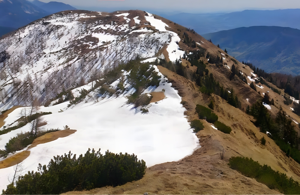
Slovenia and Austria @imgur/Pinterest
The mountain’s summit serves as a peaceful meeting point, contrasting with the historical conflicts that have shaped European borders. It symbolizes the unity between Slovenia and Austria, bound by natural beauty and shared environmental values.
22. Russia and US
Border: Diomede Islands
Area: 3.8 km* apart at their closest point
Est. Gross Domestic Product: $4.148 trillion (Russia) / $27.36 trillion (USA)*
The Diomede Islands in the Bering Strait present one of the most striking geographical juxtapositions between Russia and the United States. Big Diomede, belonging to Russia, and Little Diomede, part of Alaska, are separated by just about 2.4 miles (3.8 kilometers) of icy waters but also by the International Date Line, making them 21 hours apart.
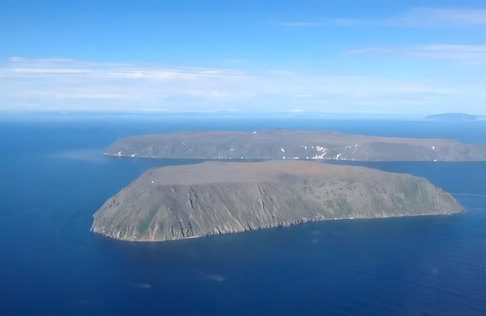
Russia and United States @Google/Pinterest
This proximity allows for a unique phenomenon where one can literally gaze into “tomorrow” from the American island. The islands symbolize both division and connection — a physical representation of the Cold War era’s “Ice Curtain” and a reminder of the natural world’s indifference to human geopolitical constructs.
23. Italy and Slovenia
Border: Julian Alps to the Adriatic Sea
Area: 232 km*
Est. Gross Domestic Product: $2.629 trillion (Italy) / $68.108 billion (Slovenia)*
The border between Italy and Slovenia is a testament to Europe’s complex history and evolving unity. Since Slovenia’s accession to the European Union and the Schengen Area, this boundary has transformed from a stark divide during the Cold War era into a symbol of European integration.
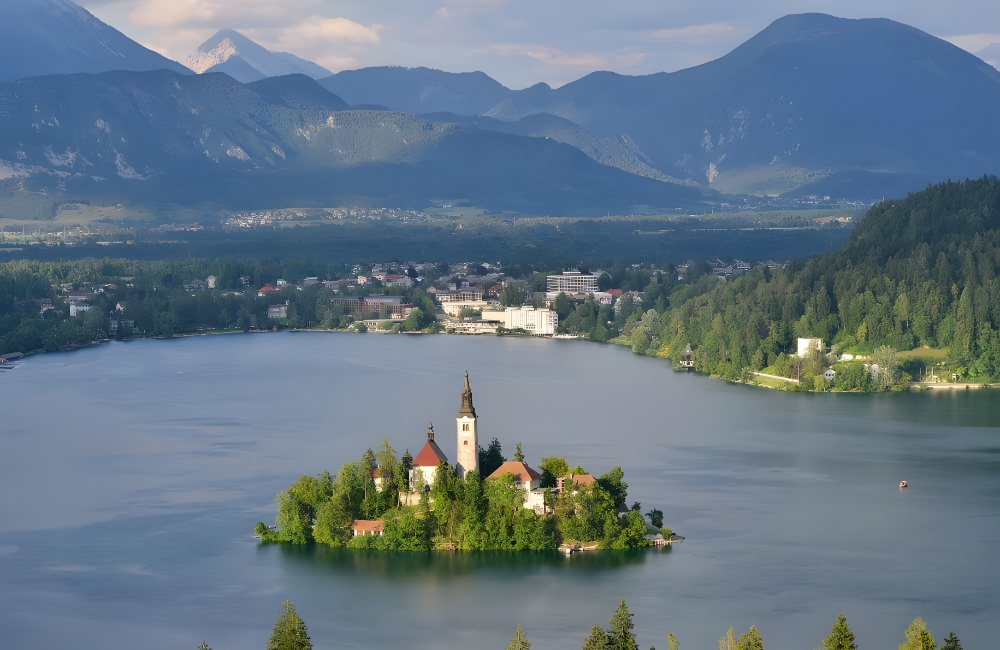
Italy and Slovenia ©Natalija Sahraj/Shutterstock
Stretching across diverse landscapes from the Julian Alps to the Adriatic Sea, the border region showcases a blend of cultural and natural beauty. Today, residents and visitors move freely across, celebrating the seamless connection between Italy and Slovenia, a once heavily guarded frontier now emblematic of peace and cooperation in a united Europe.
24. Bosnia and Croatia
Border: Neum Corridor
Area: 22 km* of coastline
Est. Gross Domestic Product: $55 billion (Bosnia) / $174.55 billion (Croatia)*
The Neum Corridor is a fascinating geopolitical anomaly, granting Bosnia and Herzegovina a sliver of coastline along the Adriatic Sea, amidst Croatian territory. This 22 km stretch of land is not just Bosnia’s access to the sea but also a historical artifact, its origins tracing back to the 1699 Treaty of Karlowitz.
Bosnia and Croatia @BintingM/Twitter
Designed as a strategic buffer to protect the then-republic of Dubrovnik from Venetian expansion, this corridor has survived the tides of history, from Ottoman rule to modern-day borders. Today, it serves as a vital economic and strategic outlet for Bosnia and Herzegovina, while also posing unique challenges and opportunities for both Bosnia and Croatia in terms of border management and regional cooperation.
25. Lesotho and South Africa
Border: Entirely surrounded by South Africa
Area: 909 km*
Est. Gross Domestic Product: $5 billion (Lesotho) / $812 billion (South Africa)*
Lesotho, the Kingdom in the Sky, presents a unique geographical phenomenon as the only country in the world to be entirely elevated above 1,000 meters. Its border with South Africa is a striking example of an enclave, with Lesotho nestled entirely within South African territory. This distinctive setup creates a symbiotic relationship, yet Lesotho retains its cultural and political independence.
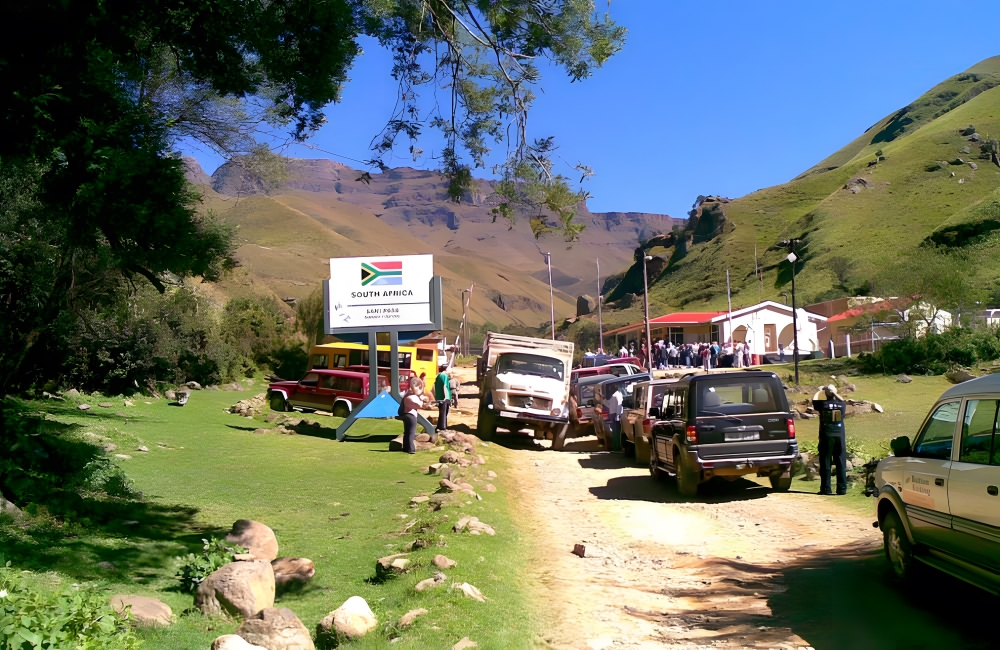
Lesotho and South Africa ©arclient/Wikimedia
The border, marked by 11 functional road crossings, facilitates a vital connection for trade, travel, and cultural exchange between the two nations. Despite its encirclement, Lesotho’s rugged terrain, featuring mountains and rivers, provides a natural fortress, preserving its sovereignty and offering breathtaking landscapes that underscore its nickname.
26. France and Spain
Border: Pheasant Island
Area: Changes ownership every six months, area not applicable
Est. Gross Domestic Product: $3.049 trillion (France) / $1.582 trillion (Spain)*
Pheasant Island, nestled in the Bidasoa River, represents a unique diplomatic relic between France and Spain. This tiny, uninhabited island has the distinction of changing sovereignty every six months, a tradition upheld since the signing of the Treaty of the Pyrenees in 1659.
France and Spain ©EQRoy/Shutterstock
This arrangement, one of the earliest examples of a condominium, symbolizes a commitment to peace and equal partnership between the two nations. The island itself, off-limits to the public except during the ceremonial transfer of power, serves as a living monument to diplomatic innovation and mutual respect. Its history and ongoing role as a shared territory underscore the possibilities for peaceful coexistence and negotiation in international relations.
27. Egypt and Sudan
Border: Bir Tawil
Area: 2,060 km²*
Est. Gross Domestic Product: $1.471 trillion (Egypt) / $340 billion (Sudan)*
Bir Tawil stands as an anomaly in modern geopolitics, a rare piece of Earth’s surface that is truly terra nullius, unclaimed by any nation. This desolate stretch of desert, caught between Egypt and Sudan, is the result of a colonial-era border demarcation that left it in limbo.
Egypt and Sudan @Google/Pinterest
The peculiar stalemate arises from a desire by both nations to claim the resource-rich Hala’ib Triangle to the east, leaving Bir Tawil unclaimed to avoid relinquishing their claims on the more valuable territory. This trapezoid-shaped expanse of land, devoid of permanent inhabitants or natural resources, inadvertently becomes a testament to the complexities of international borders and territorial disputes.
28. Tasmania and Victoria, Australia
Border: Boundary Islet
Area: 85 m*
Est. Gross Domestic Product: $38.58 billion (Tasmania) / $568,866 million (Victoria)*
Boundary Islet, a diminutive piece of land nestled between Tasmania and Victoria, Australia, hosts one of the most unusual state borders in the world. Spanning a mere 279 feet, this accidental boundary was overlooked when the Tasmania-Victoria border was delineated in 1825.

Tasmania and Australia @Google/Pinterest
Its discovery added a quirky footnote to Australian cartography, turning an uninhabited islet into a shared territory between two states. Today, Boundary Islet serves as the exclusive domain of wildlife, including New Zealand fur seals and crested terns, making it a natural bridge rather than a divider. This unique border situation encapsulates the often arbitrary nature of human-drawn lines and their unexpected consequences on the natural world.
29. India and Bangladesh
Border: Cooch-Behar enclaves
Area: Unknown
Est. Gross Domestic Product: $3.73 trillion (India) / $1.131 trillion (Bangladesh)*
The India-Bangladesh border in the Cooch-Behar district presented one of the world’s most complex border puzzles, featuring a labyrinth of enclaves within enclaves, reminiscent of a geographical inception. This intricate arrangement consisted of sovereign pockets of India encased within Bangladeshi territory and vice versa, including a third-layer enclave—a rarity in international borders.
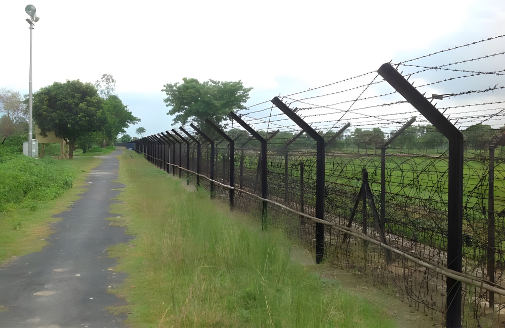
India and Bangladesh @thedailystar/Pinterest
This bewildering setup was a legacy of historical treaties and local kings’ whims, complicating the lives of residents with regards to nationality, access to services, and legal jurisdiction. The 2015 Land Boundary Agreement between India and Bangladesh significantly simplified this conundrum by exchanging the majority of these enclaves, thereby untangling decades of geopolitical complexity.
30. All of Australia
Border: Maritime boundaries with neighboring countries
Area: Over 59,000 km*
Est. Gross Domestic Product: $1.35 trillion*
Australia’s international borders are uniquely defined by the vast expanse of ocean that surrounds the continent, distinguishing it from nations bordered by neighboring countries. This maritime boundary, shared with countries like Indonesia, Timor Leste, Papua New Guinea, New Zealand, and other Pacific nations, highlights Australia’s geographical isolation as well as its strategic position in the Asia-Pacific region.
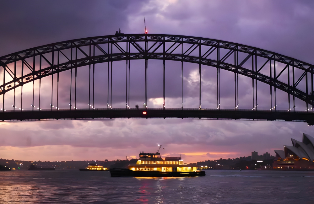
All of Australia @Google/Pinterest
The surrounding seas not only serve as natural barriers but also forge connections, facilitating trade, travel, and cultural exchange. Australia’s coastline, stretching over 59,000 kilometers, is a treasure trove of biodiversity, home to world-famous beaches, vibrant coral reefs, and bustling marine life.