Nepalese floods
In Nepal’s central and eastern districts, monsoon rains inflicted terrible floods and landslides. After the floods, Canada, a founding member of the International Charter “Space and Major Disasters,” released photos obtained by the RADARSAT Constellation Mission satellites. The flooded areas in this image have been highlighted with colour.
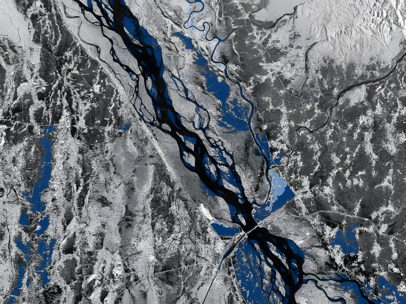
Government of Canada (), RADARSAT Constellation Mission Imagery The Canadian Space Agency has authorised the use of the mark RADARSAT. Emergency Geomatics Service from Natural Resources Canada’s value-added products