5. Altocumulus: The Mackerel Sky
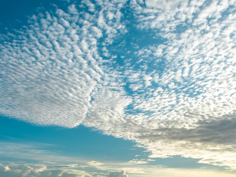
Usually developing between 6,500 and 20,000 feet, altocumulus clouds occupy the middle levels of the troposphere. Because their resemblance to fish scales when scattered throughout the heavens, these clouds are sometimes referred to as a “mackerel sky”. Usually structured in parallel bands or waves, altocumulus clouds—which consist of water droplets and occasionally ice crystals—appear as spherical masses or rolls that grab the sight and imagination of sky watchers.
These clouds can be really good markers of forthcoming changes in the temperature. The old weather lore “mackerel scales and mares’ tails make tall ships carry low sails” speaks of the mix of altocumulus and cirrus clouds as a portent of approaching storms. Often appearing 12 to 24 hours before a front arrives, this proverb emphasizes the ability of altocumulus clouds to precede more major weather events, however not always true.
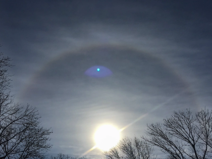
Each of the several subtypes of altocumulus clouds has special qualities. Often signaling atmospheric instability and the possibility for thunderstorms later in the day, Altocumulus castellanus, for instance, resembles little castles or turrets rising from a common foundation. Because of their smooth, saucer-like look, altocumulus lenticularis—lens-shaped clouds—often go mistaken for UFOs. These clouds develop in the atmosphere as moist air passes over mountains or hills producing standing wave patterns.
Particularly during sunrise or sunset when they capture the golden light, altocumulus clouds can produce beautiful sky sceneries that accentuate colors and patterns over the heavens. Their complex reflections and refractions of light often produce amazing visual effects, including iridescence—a rainbow-like play of hues along the cloud margins.
6. Stratocumulus: The Low-Lying Patchwork
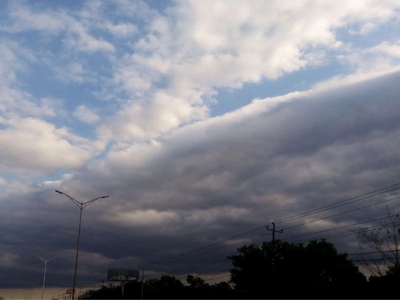
Usually found as a patchwork quilt spanning the heavens, stratocumulus clouds are low-level clouds. Usually forming below 6,500 feet, these clouds have a gray or white look that usually features darker spots or rolls. Common sight in many regions of the world, stratocumulus clouds can cover large areas of the sky and produce a unique pattern that might last for hours or even days.
Slightly rising air currents meeting a layer of stable air above causes the moisture to condense into cloud droplets, forming stratocumulus clouds. This mechanism frequently occurs in the context of a mild temperature inversion, in which case the air temperature rises with height rather than generally falling. Acting as a “lid,” this inversion captures moisture and lets these low-lying clouds develop and disperse.
Sometimes stratocumulus clouds allow peeks of blue sky between their cloud patches, a phenomena known as “fair-weather stratocumulus.” This variation in thickness can produce lovely patterns of light and shadow on the ground, particularly early morning or late afternoon when the sun is at a low angle.
Although they hardly provide precipitation on their own, stratocumulus clouds can be prelude to more significant cloud formations. Often building vast decks over chilly ocean waters, marine stratocumulus clouds are essential in coastal areas in controlling local temperatures. For days or even weeks, these cloud decks can influence temperature patterns and precipitation in surrounding coastal areas. Often reflecting sunlight back into space, these clouds can have a major effect on local temperature, therefore keeping it colder during the day.
Seeing stratocumulus clouds can help one get important understanding of local meteorology. In the lower atmosphere, their movement and development can provide wind direction and speed indication. Professional meteorologists as well as weather buffs should find them to be a valuable tool since variations in appearance over time might indicate approaching storms.